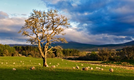
A single Scots pine grows from a boulder standing in the middle of Achness waterfall in Glen Cassley in the Highlands. It is a striking sight. Isolated in the fiercely flowing river Cassley, the tree towers above a long stretch of rocks swept by torrents of water. Salmon leap upriver in summer while golden eagles swoop overhead. It is an image of Scotland at its glorious, scenic best and would be expected to attract tourists in their droves. But in Glen Cassley, 50 miles north of Inverness, visitors are conspicuous by their absence.
Indeed, according to the Ordnance Survey, its map of Glen Cassley is the least purchased item in the entire OS Explorer map series. “Getting up there is only for the more hardy of us, perhaps, but it is still not clear why the map should be so unpopular,” said Nick Giles, the managing director of Ordnance Survey Consumer.
The Ordnance Survey now sells 1.7m paper maps a year (an increase on previous years) but is coy about sales of individual maps “for reasons of commercial sensitivity”. However, it recently revealed that its most popular map – Explorer OL17 of Snowdonia and Conwy Valley – sells about 180 times more copies than its worst seller, Explorer map 440: Glen Cassley and Glen Oykel. In other words, for every person who uses a map to explore the waterfalls and moorland of these two glens, there are 180 who would rather make the most of the crags and tracks of Snowdonia.
Certainly some of this disparity can be blamed on remoteness. Glasgow is more than 200 miles to the south. Nevertheless, the area still seems curiously unloved even closer to home.
Inverness tourism office had stackloads of local Explorer maps during my visit – with one exception, map 440. Similarly, the WH Smith nearby also had shelves groaning with cartographic offerings but only one of Glen Cassley. This may not be the map that time forgot, but it is not far off.
“Essentially we are dealing with the least populated place in Britain,” said Dave Robertson, an OS surveyor for the Highlands. “There are a few dozen houses inside the land covered by map 440 but many of these are only sporadically inhabited holiday homes or shooting lodges.”
Robertson estimates that there are fewer than a couple of hundred people living in the 826 square kilometres covered by map 440. “By contrast, there are other OS Explorer maps which cover areas with millions of inhabitants,” he added. “Essentially the Glen Cassley area is an empty zone.”
It is Robertson’s job to update OS maps when new roads are built, mobile phone masts put up, houses constructed or wind farms erected on hill tops.
Mapping these features was once a laborious process involving theodolites and other instruments but has been transformed by digital technology. Now Robertson uses a two-metre pole – known as a Global Navigation Satellite System receiver – that is fitted with GPS sensors. They can pick up a combination of US, Russian and Chinese satellite signals that allow him to pinpoint his position on Earth’s surface with centimetre accuracy.
“You follow the line of the road or track you that are mapping and the GPS receivers marks your route on your laptop. Then you record what the surface is made of – grass, or tarmac, or soil.” All that information is recorded and is then used to generate a new map of the area. It is a constant business even in the Highlands. Or at least in most parts.
“The one exception to all that activity is Glen Cassley,” said Robertson. “I have very little to do there. It doesn’t change and nothing much happens there to require new mapping.” That lack of activity and isolation gives the area its grand, bleak beauty. There are no villages within its borders, and only a handful of farms, a couple of hotels, and a few roads, nearly all of them single track. By contrast, there are acres of blanket bog covered with blaeberries (bilberries), heather, bog cotton, tormentil and an exotic range of fungi including the purple amethyst deceiver.

Some of Scotland’s finest fishing rivers cut through this boggy land and there are stunning waterfalls and salmon leaps. Bird life includes buzzards, stonechats and an occasional golden eagle.
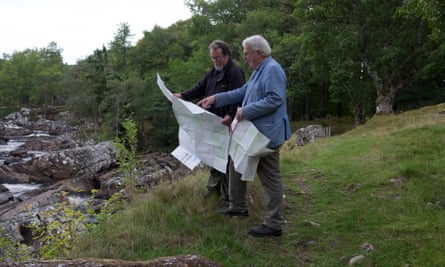
On my visit last week, Dave Robertson and I strolled through these wonders that were only intermittently blighted by rain or midges. We met only one set of fellow walkers – who looked aghast when I explained that I would be writing about the region. “Please don’t let everyone else know about this place,” they pleaded.
In fact, the Ordnance Survey says it is very keen to get more and more people to know about lost national treasures such as Glen Cassley. At the end of this month, on Sunday 30 September, the OS will be promoting National GetOutside Day when it hopes to get as many as a million people to take trips, walk and enjoy the outdoors. Thousands of routes around Britain will be promoted in the process.
“Once people realise what is on offer in places like Glen Cassley, they could make a lot of difference,” said Giles. “Certainly, it would be good if we could get Glen Cassley off the bottom of this year’s sales charts though that would only mean we would have to try to do the same for the current second bottom selling map – Peterhead and Fraserburgh – next year. And that might be harder.”
Lost and found
The origin of the Ordnance Survey can be traced to the government’s decision to map the Highlands in the wake of the Jacobite rebellion. British troops, in pursuit of the defeated rebels, found they had no proper maps to help them locate their enemies. So the government launched a mapping exercise that produced the first detailed maps of the Highlands and later the rest of the country.
Today the OS has two main series of British maps: the Landranger with red covers and the Explorer with orange covers. The latter are scaled 1:25,000, in which 4cm represent 1 km. Landranger maps at 1:50,000 scale have less detail but more coverage on a single sheet.
The top 10 most popular Explorer maps all cover areas of England and Wales. The 10 least popular all cover areas of Scotland.
The top three are:
OL17 Snowdonia and Conwy Valley.
OL7 the Lake District, South Eastern section.
OL24 the Peak District.
The three least popular are:
OS440 Glen Cassley and Glen Oykel.
OS427 Peterhead and Fraserburgh.
OS333 Kilmarnock and Irvine.

Comments (…)
Sign in or create your Guardian account to join the discussion